Well, today is the last official day of the trip and I am a bit melancholy. I need to get back to work though, before they figure out that they don't miss me.
It's been a great, fun, wet, cold, sunny, windy, etc. trip. I hate to see it end because there is so many other things to see. I'll be honest, I am a bit tired though. Logged 354 miles today for a total of 3981. It will be over 4000 by the time that I drop my bike off to be shipped. The weather today was great. Started off at 64and ended up almost 80 here in Seattle.
Today, I took another "road less travelled". I took Hwy 2 from Spokane to Everett and then I5 down to Seattle. Hwy 2 basically parallels I90, but has more "character". You go through so many small towns with historical markers. It is fun to see why some of these small towns popped up in the middle of nowhere.
I'll will post a few more pics once I get home from my camera. There is a limit on what can be uploaded from a mobile device. A few pics from Lake Louise and Moraine Lake where I forgot to take any with the blackberry.
Thanks to everyone that was following this blog. I hope that you enjoyed the pictures and the note of what I was seeing and doing.
Next years trip will be the middle of the country over to New York and back down and the year after will be the Northeast when the leaves start to change.
Signing off for now.
Thanks
John
Sunday, August 16, 2009
Start of last day
OMG, the sun is shining!!! It started off around 64 degrees and was sunny. I didn't have to wear "long johns" or put on my leather chaps. I did start off with the leather jacket, but peeled that off before lunch. The day was nice and sunny all day.

"For Amber waves of grain..."
There was about a 100 miles of land like this starting just west of Spokane. I couldn't help singing "America the Beautiful"

Dry Falls off Hwy 17
I took a short detour off of Hwy 2 to go see this again. It is an amazing site. These ancient falls dwarf the size of Niagra Falls. These falls were over 3 1/2 miles wide and occurred about 13,000 years ago as the result of a glacial ice dam that broke up valley.

Along Hwy 2 from Spokane to Everett, WA
For about a 100 miles from Spokane, it was prairies, then about 50 miles of "transitional" land like this picture, them about a 100 miles of passing over the Wenatchee Mountains.

Wenatchee river
This was the river of the day. Each day, it seemed that I got to follow along a river in the valleys.

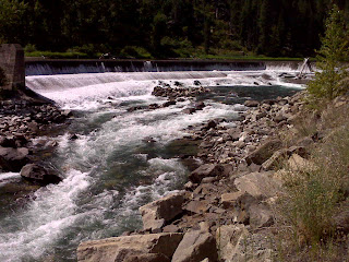
Small dam on Wenatchee river
This was a cool little dam on the river. It created a small lake on the other side that a lot of people were swimming in.
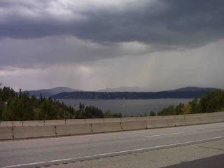
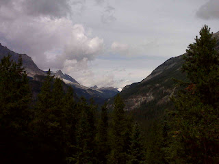
Mt Rainier finally
Don't know if you can make out Mt Rainier, but it is the white thing in the middle. It is an amazing site. Also, this is the end of the last day. Sunny from morning to the end of the day.

Saturday, August 15, 2009
Day 10 Babb, MT to Spokane, WA
Well, they were predicting mid 30's and snow for the area with 6 inches at Logan Pass. If is was true when I woke, I didn't know what I was going to do.
However, the weathermen were wrong again...thank goodness. It was partly cloudy and 45 to start. As I headed up to Logan Pass, the low clouds started moving in. By the time I got to the summit, it was 39 degrees and I could not see more than 50 feet and it was snowing and sleeting a bit. Started to head down and drove in a cloud for 4 miles. I followed the car ahead of me and I could barely make out its tail lights. Only got to see one glacier in Glacier National Park.
The rest of the day was in and out of a few rain showers, but a nice drive. I'm sure if I could have seen more, it would have been nicer.
It was 70 degrees by the time I got to Spokane, but got caught in one last shower.
Today's distance 352 miles for a total of 3627.
Tomorrow is the last full day and I am taking the long way back to Seattle. Hopefully the weather will cooperate.
Day 9 Canmore, Canada to Babb Montana
Started later (about 10:45 local time) to miss the rain. Got up at 8:00 and it was raining, so I went back to bed for a while. The rain had stopped, but there were low clouds and it was overcast.
It was a nice cool drive early with the clouds clearing some. The drive on Hwy 40 through "Kanaskis Country" was beautiful. It follows that Canadian Rockies and the Continental Divide for about 70 miles.
The weather started to change once I headed into "the prairies" as the locals like to call them. Got on Hwy 22 which is called the Cowboy Trail and it is very similar to Texas. Lots of cattle ranches and hay fields. It was along here that I got into some heavy rain for about 45 miles. At least the road was mainly straight and I was not in the mountains. After these rains, it started to clear up a bit.
The last 20 miles or so heading into Babb was "open range", cows and horses were just grazing along the highway. There were signs to watch out for them, so they didn't get out of a fenced in area. A little weird
Traveled 259 miles on day 9 for a total of 3275 and the temperature range was only 45-50 the entire day. It's gonna seem hot in Texas when I get back.
Start of day 10
They were predicting mid 30's and snow (6 inches at Logan Pass), but I got this to start.

End of Day 10
Almost made it to Spokane without any more rain, but not quite. I missed most of this however.
Jackson Glacier
Look right above the trees in the bottom of the "V". This was the only glacier that I saw in the park.

St Marys lake
This lake is at the east end of Glacier Nat'l Park. I don't know if you can see the whitecaps, but the wind was really blowing.

Coming down from Logan Pass
OK, Logan Pass is supposed to be spectacular, but I didn't see anything. About a half a mile from the summit, I drove into a cloud and actually missed the turnoff. I drove for 4 miles on mountain switchbacks with no more than about 50 feet visibility. I stuck on the bumper of the car ahead of me. Logan Pass is up in the clouds in this pic.

Going to the Sun road
Not much sun today. Only the beginning of the day had any sun, but there were still some views like this one.


The forces of Mother Nature
It's hard to see in this picture, but between the two peaks, you can see where the rocks split in opposite directions. Must have been an enormous sound when that happened.

Low clouds before afternoon rains
The clouds started to move in and it started raining soon after for about 45 miles. The clouds looked cool coming in though.

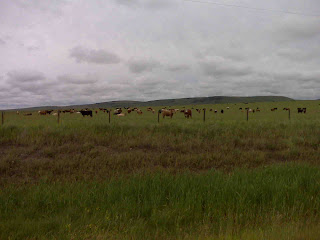
Canadian cows look like Texas cows!!!
Stopped to get a pic of some Canadian cows. They must have thought that I was there to feed them, because soon after they were all against the fence.


The town of Babb...all of it!
I'm not kidding, there was the place I stayed, the gas station and the Babb press, the Cattle Barron's Supper Club (good steak) and Charlie's Roadhouse.


Start of day 9 in Canmore, Canada
Pretty typical for here. This was my third time to be in Canmore and it was the third time it looked like this.

Are you kidding me!!!
Why is it a Texas Gate? Did they start in Texas? A bit later, one was just painted on the roadway. Wonder if it really tricked the livestock?


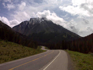
Along Hwy 40
This was a beautiful drive from Canmore towards Babb. It followed the Canadian Rockies.

Avalanche trails along Hwy 40
There were several areas like this along the highway. Really shows the tremendous force of an avalanche. Some were more recent and others, you could see where the trees were starting to grow back.

Thursday, August 13, 2009
Day 8 Revelstoke to Canmore Canada
Well I slept in a bit today since the weather was supposed to be crappy and I didn't have far to go. Woke up looked out the window and the sun was shining. Decided I better get going.
There were a lot of bikes this morning all heading the same direction. Found out the the national HOG (Harley Owners Group) rally is this weekend in Calgary.
Not a lot of pics today since the scenery looked the same all day. I was such a bonehead and forgot to take any pictures of Lake Louise and Moraine Lake with the blackberry. Will upload some from my camera when I get home.
The weather was nice in the beginning. About 60 to start, but it was 48 and raining here in Canmore.
Only logged 216 miles today for a total of 3016.
Fridays forecast 39 and raining to start and 46 and raining to end. Hpoefully they are wrong.

Bow River near Lake Louise
The weather was starting to take a turn for the worse. I was in a hurry to get some pics of Lake Louise and Moraine Lake, that I forgot to get any with the blackberry to upload. You will have to wait until I get home to see these two lakes.


Wednesday, August 12, 2009
Day 7 Chilliwack to Revelstoke Canada
Today was very nice and relaxing. I got to stay on Trans Canada 1 the entire day. Trans Canada 1 between Hope and Kamloops reminds me a lot of Route 66. There is a new toll road (Hwy 5) that bypasses this part of Hwy 1 and many of the small towns are starting to fade away. There are so many neat towns that you have to slow down to pass through and many of the businesses are closing down. It is a beautiful drive, but not heavily travelled.
All day was in valleys. There was a ton of one particular crop that I didn't have a clue what it was. It looked like weeds and was 1 to 3 feet tall, but they felt like they needed to water it. Also lots of berries again. I was also surprised by the amount of dairy and beef cattle.
Starting to get a bit used to this metric stuff. When is says that it is going to be 20-26 degrees, that means about 68-80, which is what it was today.
Tomorrow is a different story, it's supposed to be a high of 53 with a low of 38 with a 90% chance of rain in Banff. This will be the third time to be in Banff and the weather has always been the same :( Oh well, the weathermen have been wrong and I'm praying for no rain. I can handle the temps.
I checked into the hotel the same time as 2 other bikers did. We ended up having a steak dinner together across the street. They were both correctional officers at the Headingly Correctional Center in Manitoba. They had some interesting stories!!!
Logged 349 miles today for a total of 2810.
Typical view today
Most of the day was in valleys like this one. Some were wider than others and there was a lot of agriculture and dairy farms.

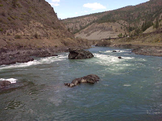
Thompson River
I followed this river for quite a while. Kept crossing bridges and it would be on the right then on the left.
Small church in Spences Bridge Canada
I actually turned around to get a picture of this church. I bet the weekly attendance is pretty light!!!


Not Upside Down
Look closely, it is not upside down. I took a picture of the water with the reflection.

Small Lake near Revelstoke
This was a small lake about 10 miles from Revelstoke and I just caught a glimpse of it before it was too late to stop. It was worth it.

Tuesday, August 11, 2009
Day 6 Hood River, OR to Chilliwack Canada
The day started out promising. Looked like the weather was clearing out and was 66 degrees. The more I drove, the thicker the fog and clouds got. As I approached Mt St Helens, I had to pull over and put my rain gear on. As I was driving to Windy Ridge, you could see the first sign of the devastation about 10 miles from the ridge. It started raining pretty hard and I almost turned around, but though what the heck, I've come this far. I continued on and the clouds cleared a bit. You still could not see the top of what's left of Mt St Helens, but you could see most of where the mud flow was. I did not know that the eruption was caused by an earthquake. The earthquake caused the north side of the mountain to slid away and this released the pressure from the mountain.
I then headed on to Mt Rainier (notice the "rain" in the name). I didn't see any of the mountain. I was in the fog, mist, rain, clouds, sun, more rain, above the clouds, in the clouds, below the clouds most of the time. I was in inclement weather for 5-6 hours.
It dried up as I got closer to Seattle. The drive up into Canada was very nice and it was 80 degrees when I got here.
Hopefully that's the last of the rain.
I wish that I had paid better attention when they were trying to teach us the metric system (remember the US was going to convert in the 70's). Anyway, it's going to be 24 degrees tomorrow and that sounds cold to me, but it;s supposed to be nice and how high is 4.08 meters...that was the height on a bridge. My exit was 1200 meters away, what the heck does that mean and finally, the speedometer on the motorcycle is only in M.P.H, so it will be fun to figure out what the K.P.H. equivalent is.
Tomorrow is a "just getting there" day. It is the only day where I will be on the same highway (Trans Canada 1) for the entire day. Chilliwack to Revelstoke
Today's miles - 385 for a total of 2461
Mt Rainier Can you see it???
Yeah, neither could I. This was the best view that I had all day. Can't be sunny everyday!!!

Mt Baker
What is it with the clouds and the mountains? Considering the beginning, It was a beautiful end to the day. Just south of the Canadian border.

Nooksack Valley
This area was just a few minutes from where I crossed into Canada. Very nice peaceful valley. Lots of strawberry and raspberry fields.

Result of 1980 eruption
This is one of the first views that you see of the devastation. This is not even the worse side. You can always tell which direction Mt St Helens is...the trees have all fallen the opposite direction.

Logs in Spirit Lake
All of the logs float to this end of the lake. Harry Truman lived here and refused to leave his lodge. He was given special permission to stay and forever is entombed under 30 feet of mud and ash.

Spirit Lake
These logs have been floating in Spirit Lake since 1980. A large quantity of mud flowed into this lake during the eruption.

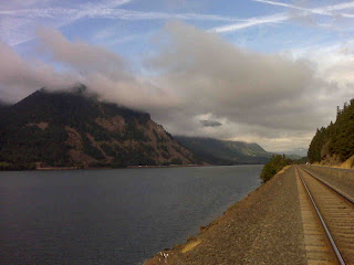
Fog over Columbia River Gorge
This was just across the river from where I stayed. It was a nice drive for about an hour until it started raining.

Subscribe to:
Posts (Atom)
